LYNNWOOD—A potent atmospheric river will unload several days of heavy rain across the Pacific Northwest starting Monday, raising the risk of river flooding, urban flash flooding, and landslides across western Washington and Oregon, the National Weather Service reports.
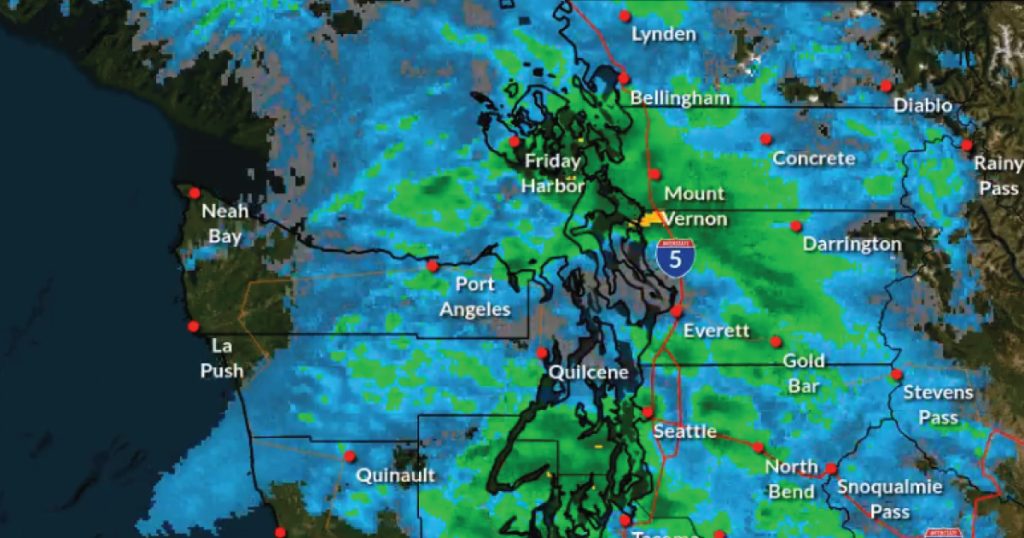
The onslaught begins Monday morning when a sub-tropical moisture begins to flow inland along a strong Pacific jet stream. Coastal areas of Washington and Oregon will see the first surge, with rainfall quickly spreading inland and intensifying through midweek. Forecasters expect 2 to 6 inches of rain in the lowlands and 4 to 10 inches across the Olympics and Cascades by late Wednesday, on top of 1 to 4 inches that fell over the weekend.
With soils already saturated, the National Weather Service has issued an extended Flood Watch for much of western Washington, including Snohomish County rivers and streams, in effect from early Monday, December 8, through Friday afternoon. The combination of prolonged heavy rain and elevated antecedent soil moisture has also heightened the threat of landslides and debris flows, particularly along steep coastal bluffs, hillside road cuts, and recent burn scars.
“Those living in areas prone to flooding should be prepared to take action should flooding develop,” the Weather Service warned in its Monday bulletin.


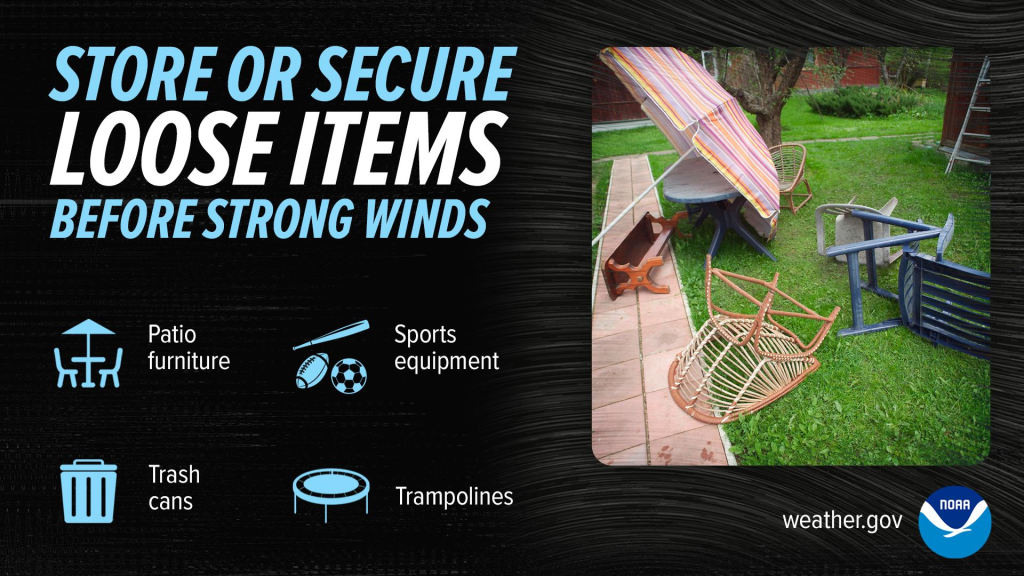
Gusty winds will accompany the rain. A Wind Advisory is in effect across Snohomish County through Monday night, with south winds of 20 to 30 mph and gusts reaching 40 mph. Forecasters say unsecured objects could be tossed about, tree limbs may come down, and scattered power outages are possible.
Residents across the region are urged to stay alert. In Snohomish County, blocked roads in unincorporated areas can be reported to Public Works at 425-388-7500 or contact.PWRM@snoco.org during business hours; after 5 p.m., call 911. The Snohomish County PUD reminds the public to stay at least 30 feet away from any downed power line and report it immediately to 425-783-1000.


Use the PUD Outage Map to view current outages, including details like cause, start time, impacted customers, and estimated restoration time.
The atmospheric river is expected to gradually weaken late in the week, but the threat of river flooding and landslides will linger for several days after the heaviest rain ends.
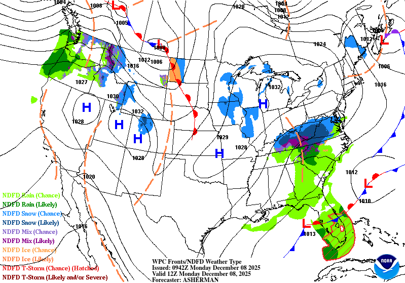
Farther east, the same energetic jet stream will spin up a fast-moving clipper system across the Canadian Rockies Monday and Tuesday. As it dives into the Northern Plains late Tuesday, a narrow corridor of wintry precipitation is expected roughly along a line from Fargo, North Dakota, to Grand Rapids, Michigan. Several inches of snow and a period of freezing rain remain possible, prompting a Winter Storm Watch for eastern North Dakota and western Minnesota.

Author: Mario Lotmore