SEATTLE—Forecasters are tracking the likely emergence of a strong El Niño later this year, with some models suggesting it could rank among the most intense events in more than a century—a “super” El Niño.
El Niño and its counterpart La Niña form the El Niño-Southern Oscillation, the dominant driver of year-to-year climate variability across the globe. During El Niño, trade winds weaken and warmer water spreads eastward along the equator, altering atmospheric circulation patterns. La Niña brings the opposite: cooler waters and stronger winds. These phases typically shift every two to seven years, with neutral conditions in between. The current transition follows the end of a La Niña episode earlier in 2026.


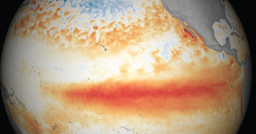
The National Oceanic and Atmospheric Administration’s Climate Prediction Center reported on May 14 that El Niño conditions are expected to develop between May and July, with an 82 percent chance, and persist through the Northern Hemisphere winter with 96 percent probability. Sea surface temperatures in key equatorial Pacific regions have been rising, fueled by subsurface heat. The European Centre for Medium-Range Weather Forecasts has projected anomalies as high as 3 degrees Celsius above average by late 2026 in some scenarios.
If the 2026 El Nino strengthens significantly, it would join a short list of powerful episodes, including those in 1982-83, 1997-98 and 2015-16. Some forecasters have drawn comparisons to the 1877-78 event, long considered one of the strongest on record, when Pacific warming contributed to widespread droughts that helped trigger famines across Asia, Africa and South America—estimated death toll from that period are approximately 50 million.


In the Pacific Northwest, El Niño tends to shift the Pacific jet stream southward, steering storms away from Washington state resulting in warmer winters that are drier than average, with reduced mountain snowpack. This pattern can extend dry conditions into the following summer, raising the risk of drought and wildfire.
In Washington state, the meteorological winter (December 2025–February 2026) and the broader cool season (roughly October 2025–March 2026) saw significantly above-average temperatures across the state.


According to the University of Washington Climate Office and NOAA’s National Centers for Environmental Information, the Northwest climate region recorded its second-warmest winter on record. Precipitation, by contrast, ended up near or slightly above normal overall—thanks to the historic back-to-back atmospheric rivers in December. Statewide totals for October–February ran about 104 percent of average despite a dry January—64 percent of normal, ranking as the 22nd-driest on record according to a University of Washington January Climate Summary.
Winter’s warming resulted in much of the precipitation as rain rather than snow, leaving mountain snowpack well below average in many basins despite the near-normal in total moisture.

Author: Mario Lotmore