The GoodMaps app, which uses light detection and ranging (LiDAR) mapping technology to create highly accurate 3D maps of large public spaces’ interiors (a state-of-the-art wayfinding tool), is now available at the Westlake and International District/Chinatown stations on Sound Transit’s Link 1 Line.
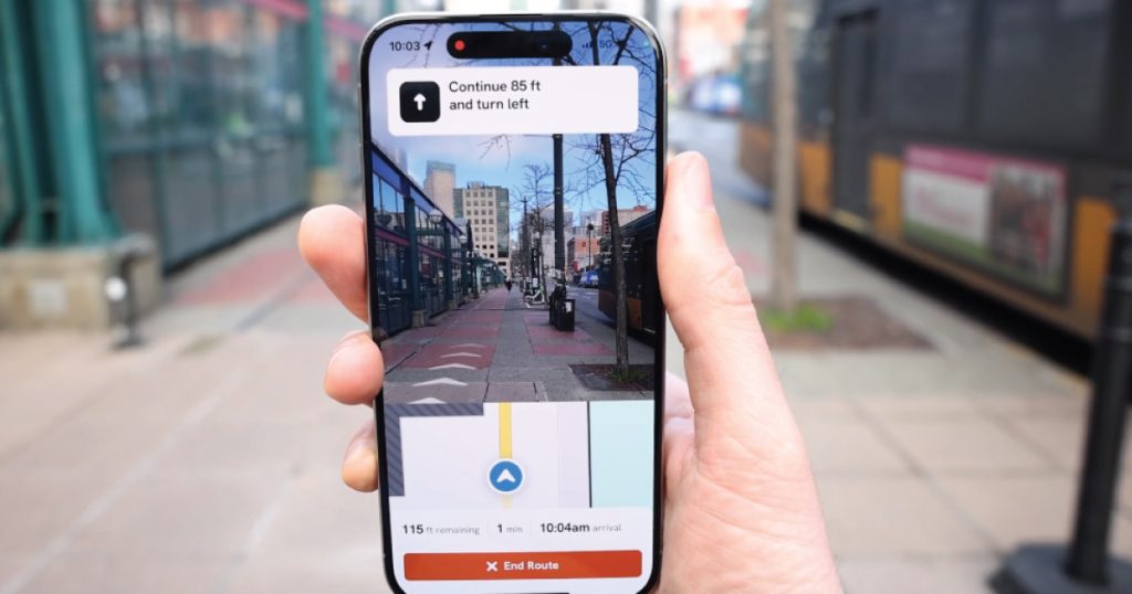
With its real-time, turn-by-turn directions via a smartphone app, GoodMaps provides accessible wayfinding for all passengers, including those who have visual or hearing impairments, are neurodivergent, or have limited mobility, as well as anyone who feels anxious or uncomfortable in new or complex environments or just wants to find their way more efficiently.


“I’m excited about the potential for GoodMaps to help make complex stations easier to navigate for passengers with vision disabilities and support independent travel for any passenger with a smartphone,” said Beth Hamby, senior accessibility program manager for Sound Transit.
Riders can view this video to see how GoodMaps works. GoodMaps also supports different languages and multimodal integrations. If the pilot is successful, Sound Transit plans to launch GoodMaps to all Link light rail stations.

GoodMaps is available on both the Apple App Store and Google Play.
GoodMaps is based in Louisville, Ky. and provides technology for universal and inclusive entrance-to-destination wayfinding. Founded in 2019 as part of the American Printing House for the Blind, GoodMaps’ mission was and remains: to further the reach of accessible navigation, irrespective of an individual’s needs or routing requirements.

Author: Lynnwood Times Staff